
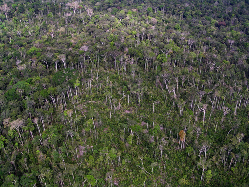
This image taken from a helicopter shows the same blowdown region a few years after the event that is imaged on the Landsat mortality map. The regrowing vegetation has covered up most of the downed trees, but some tree stems are still visible. Image credit: Berkeley Lab
(Visited 180 times, 1 visits today)