
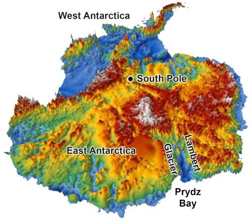
This 3-D reconstruction of the topography hidden under Antarctica’s two-mile-thick coating of ice was made using data from radar surveys. Glaciers started carving Antarctica into the current mountain-and-fjord landscape 34 million years ago, according to new findings from UA geoscientist Stuart N. Thomson and his colleagues. (Image courtesy of Stuart N. Thomson/UA department of geosciences)
(Visited 29 times, 1 visits today)