
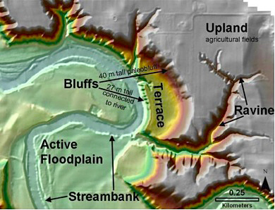
Digital elevation model of a bend in the Le Sueur River, showing four major sediment sources in its watershed: upland fields, ravines, bluffs, and streambanks. Floodplains are sediment sinks. The Le Sueur flows toward the Minnesota River from the south. Image credit: University of Minnesota
(Visited 45 times, 1 visits today)