
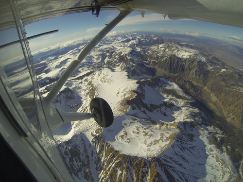
Mt. Dana and Dana Plateau in the Tuolumne River Basin within Yosemite National Park, Calif., as seen out the window of a Twin Otter aircraft carrying NASA’s Airborne Snow Observatory on April 3, 2013. The patchy snow cover this early in the snowmelt season is a reflection of the poor snowfall in the Sierra Nevada this winter and spring. The Airborne Snow Observatory is producing comprehensive weekly maps of how much water this basin holds, data that will be used to estimate how much water will flow out of the basins when the snow melts. The watershed and its Hetch Hetchy Reservoir are the primary water supply for San Francisco. Image credit: NASA/JPL-Caltech
(Visited 51 times, 1 visits today)