
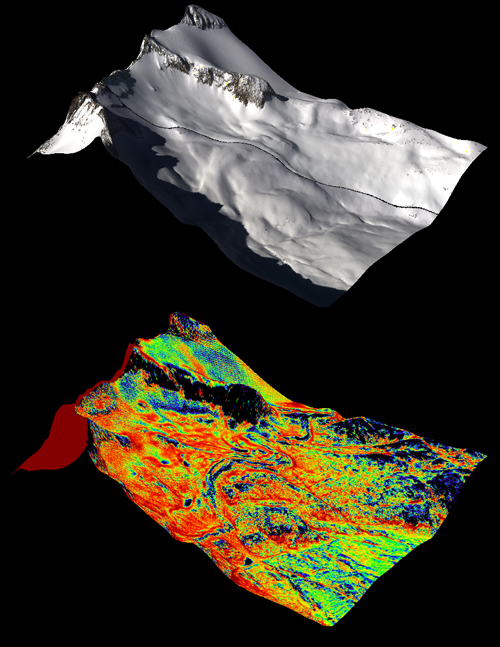
A natural color image of Mt. Lyell, the highest point in the Tuolumne River Basin (top image) is compared with a three-dimensional color composite image of Mt. Lyell from NASA’s Airborne Snow Observatory depicting snow depth (bottom image). Mt. Lyell holds the Lyell glacier, which has been in sustained retreat since the 1800s. Credit: NASA JPL/Caltech
(Visited 41 times, 1 visits today)