
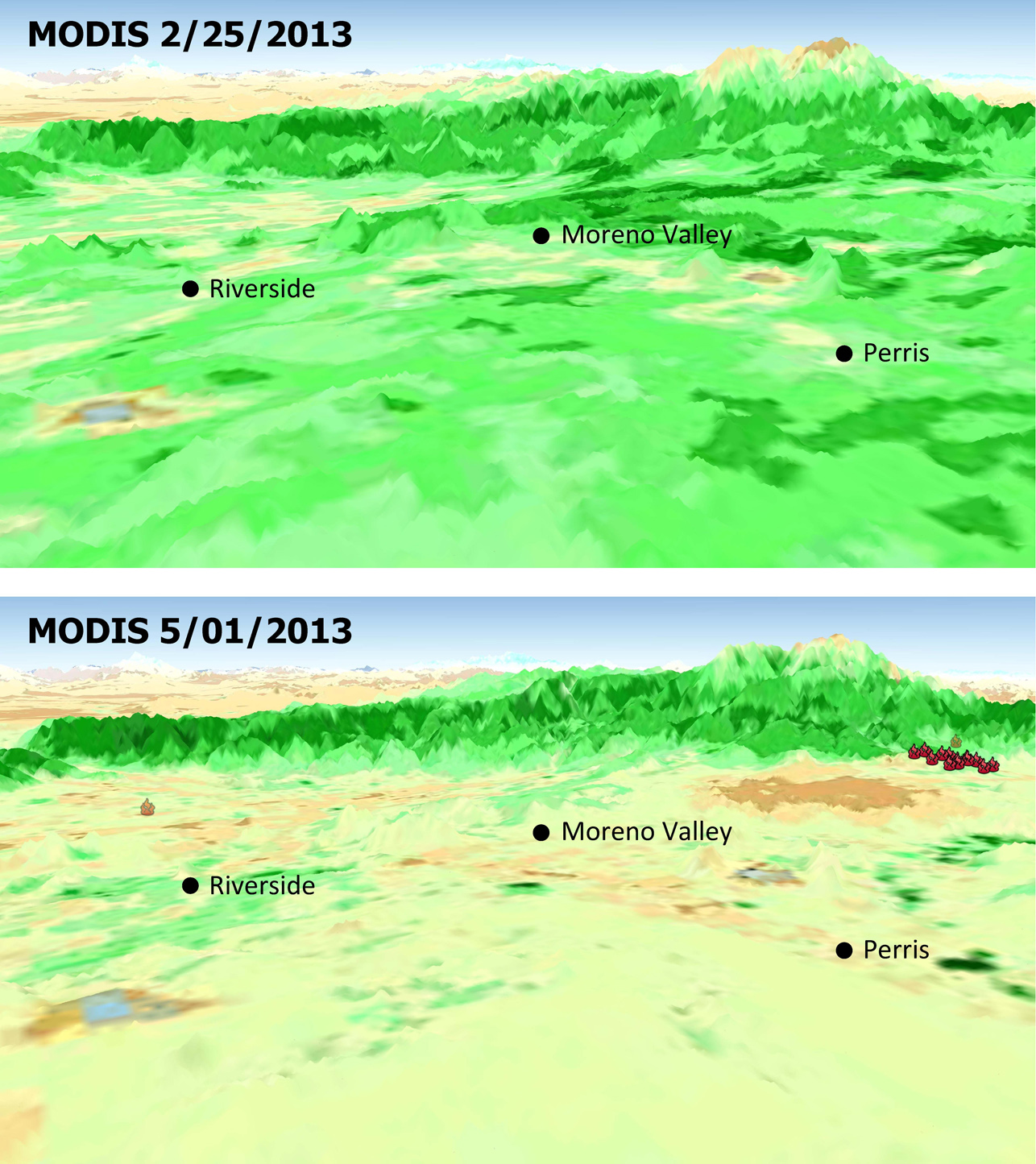
The quick dry-out of vegetation in Southern California this year is depicted in this pair of images from the Moderate Resolution Imaging Spectroradiometer (MODIS) sensor on NASA’s Aqua spacecraft. MODIS measurements show more vegetation with greener areas on Feb. 25, 2013 (upper panel), compared to those on May 1, 2013 (lower panel), which is the nominal start date for fire season in Southern California. Locations where multiple wildfires erupted in late April and May 1 are marked. Image credit: NASA/JPL-Caltech/U.S. Forest Service (Click image to enlarge)
(Visited 41 times, 1 visits today)