
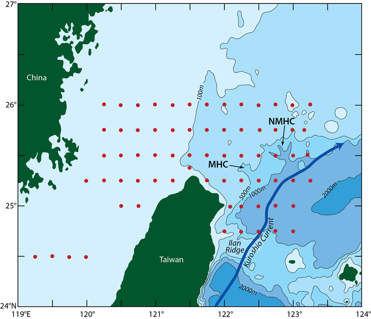
In their work to understand the strong currents over the continental shelf and slope in the East China Sea, the researchers used four ships for intensive sampling of the continental shelf and slope, and deployed several moorings and conducted high-resolution hydrographic surveys. In this figure, the red dots represent profiles of water sampled during the broad scale survey. MHC denotes Mien-Hua Canyon while NMHC denotes Northe Mien-Hua Canyon. Figure by Jack Cook, Woods Hole Oceanographic Institution (Click image to enlarge)
(Visited 47 times, 1 visits today)