
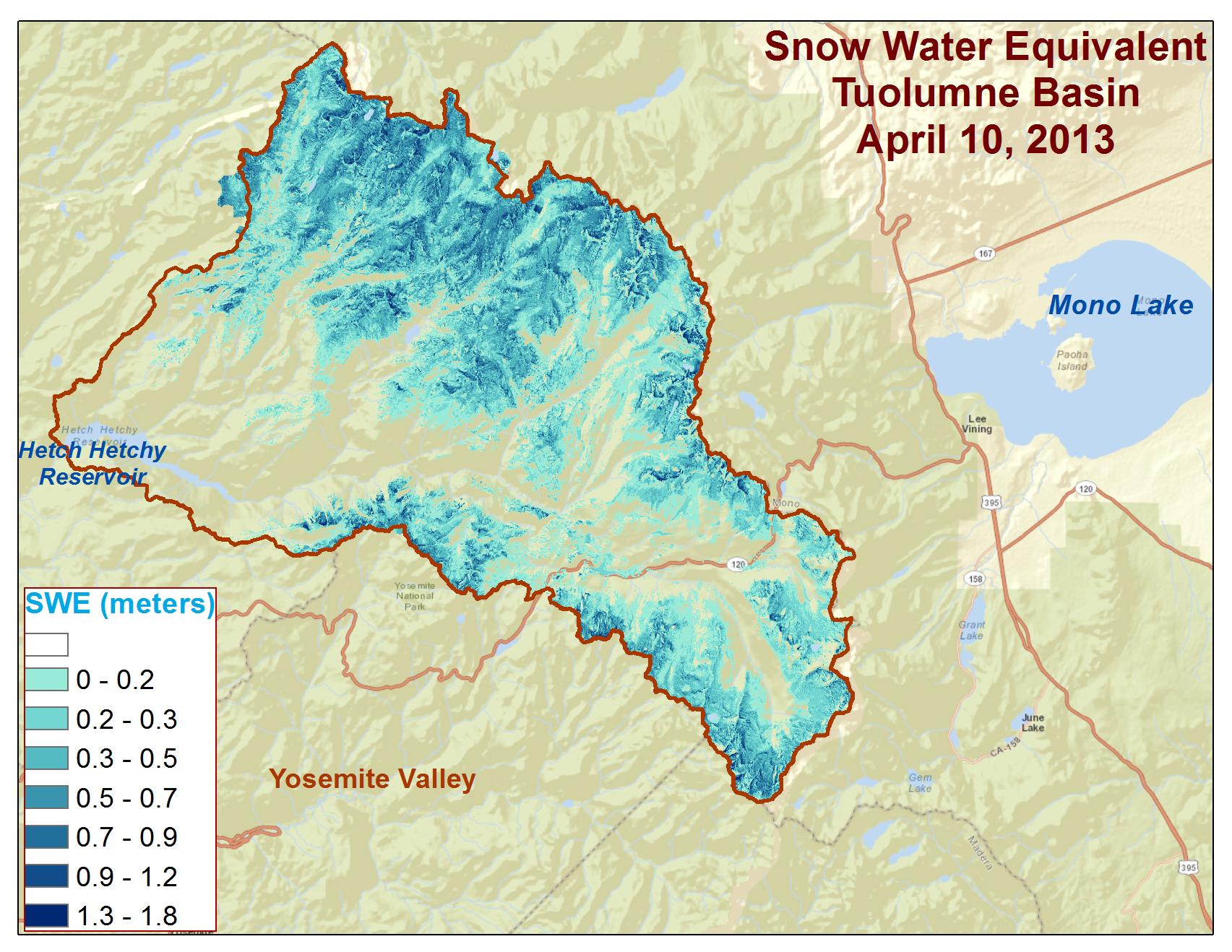
Spatial distribution of snow water equivalent across the Tuolumne River Basin from April 10 to June 1, 2013 as measured by NASA’s Airborne Snow Observatory. Image credit: NASA/JPL-Caltech (Click image to enlarge)
(Visited 42 times, 1 visits today)
Spatial distribution of snow water equivalent across the Tuolumne River Basin from April 10 to June 1, 2013 as measured by NASA’s Airborne Snow Observatory. Image credit: NASA/JPL-Caltech (Click image to enlarge)