
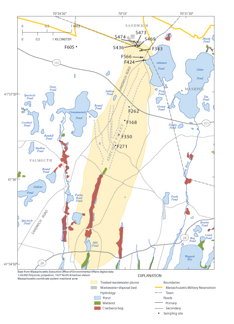
A map of the region where wastewater was disposed into the ground from 1936 to 1995, creating a 3-kilometer-long plume of contaminants spreading downstream to ponds and the ocean. The U.S. Geological Survey has installed sampling wells (labeled with black letters and numbers) to monitor the contaminants along the plume. (Map by Denis LeBlanc and Gillian Fairchild, U.S. Geological Survey)
(Visited 30 times, 1 visits today)