
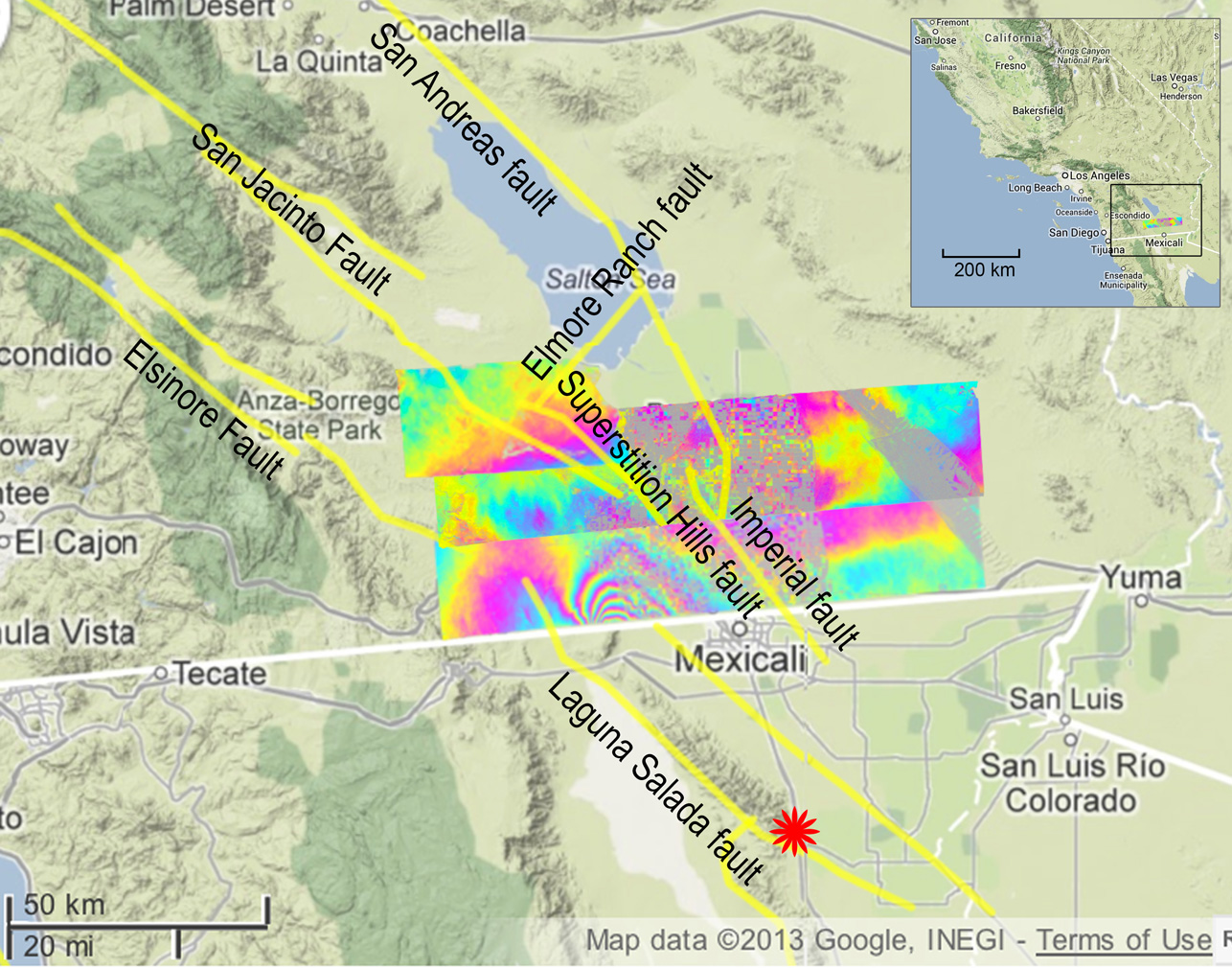
UAVSAR measurements north of the 2010 El Mayor-Cucapah earthquake, which scientists have learned was followed by quiet movement on faults in California. Inset map shows the region on the California-Mexico border. Image credit: NASA/JPL/USGS/California Geological Survey/Google (Click image to enlarge)
(Visited 32 times, 1 visits today)