
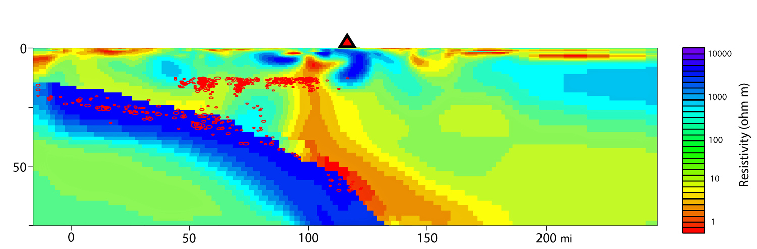
This image was made by measuring how the ground conducts or resists electricity in a study co-authored by geophysicist Phil Wannamaker of the University of Utah Energy & Geoscience Institute. It shows the underground plumbing system that provides molten and partly molten rock to the magma chamber beneath the Mount Rainier volcano in Washington state. The scale at left is miles depth. The scale at bottom is miles from the Pacific Coast. The Juan de Fuca plate of Earth’s Pacific seafloor crust and upper mantle is shown in blue on the left half of the image as it dives or “subducts” eastward beneath Washington state. The reddish orange and yellow colors represent molten and partly molten rock forming atop the Juan de Fuca plate or “slab.” The image shows the rock begins to melt about 50 miles beneath Mount Rainier (the red triangle at top). Some is pulled downward and eastward as the slab keeps diving, but other melts move upward to the orange magma chamber shown under but west of Mount Rainier. The line of sensors used to make this image were placed north of the 14,410-foot peak, so the image may be showing a lobe of the magma chamber that extends northwest of the mountain. Red ovals on the left half of the page are the hypocenters of earthquakes. Photo Credit: R Shane McGary, Woods Hole Oceanographic Institution (Click image to enlarge)